


Few stretches of American ground carry as much dread as the Forty-Mile Desert of western Nevada. For the more than 250,000 emigrants the National Park Service counts on the California Trail, the road across Nevada was a long walk beside a shrinking river, followed by a final, waterless gamble: about forty miles of alkali flat and sand between the end of the Humboldt River and the first clean water on the far side. Those who crossed it spoke of it for the rest of their lives, and those who did not left their wagons, animals, and graves behind.
This is a story that belongs to Reno and the Truckee Meadows, and to the Lahontan Valley around Fallon, where the survivors finally drank. In this guide we follow the trail across Nevada: the Humboldt route, the Forty-Mile Desert, the relief camp called Ragtown, the great singing dune of Sand Mountain, and the passes that carried the emigrants into California. We have checked each date and number against state markers and published histories, and where those sources disagree we say so.
The Humboldt Route
Across northern Nevada, the California Trail followed a single reliable ribbon of water. The Humboldt River, in the words of one standard history, runs “over 300 miles mostly westward across the Great Basin” before it ends in the Humboldt Sink, where it simply evaporates. Emigrants followed it because it offered the water, grass, and firewood their teams required, and for weeks it was their road, winding through places such as Carlin Canyon in the east.
But the river that kept them alive also led them toward the hardest test of the journey. Near its end the Humboldt spread into marsh and mud flats; a federal auto-tour guide to the trail quotes one description of the Sink as “a mud lake ten miles long and four or five miles wide, a veritable sea of slime.” Here, at the Humboldt Sink, the trail forked. One road led west to the Truckee River; the other led south to the Carson. Either way, the next forty miles had no usable water.
The Forty-Mile Desert
Nevada's own roadside marker, State Historical Marker No. 26, calls it “a barren stretch of waterless alkali wasteland” and “the most dreaded section of the California Emigrant Trail.” Because of the heat it was crossed at night whenever possible. Mark Twain, who rode the same country by stagecoach in the early 1860s, wrote in Roughing It that it “would hardly be an exaggeration to say that we could have walked the forty miles and set our feet on a bone at every step.”
The toll is recorded on that same marker. A survey made in 1850, it states, counted 1,061 dead mules, almost 5,000 horses, 3,750 cattle, and 953 graves, with the value of lost property set at $1,000,000. These are period tallies, not a modern census, and published sources round them differently; we cite them as the figures Nevada's own markers repeat. Even allowing for error, the picture is clear: dead oxen along the road, wagons abandoned to lighten loads for desperate teams, and fresh graves beside them.
The desert also set traps. About twenty miles in, travelers on the Truckee Route reached Boiling Springs, where, according to that same guide, more than a hundred mineral springs simmered in the hillside. Thirsty livestock charged the water and scalded their mouths. Hot, mineral-laden water was no relief at all. Roughly eight to ten miles of deep sand still lay between the survivors and the river.
Ragtown and the Carson River
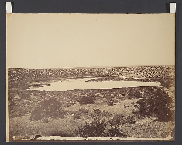
For emigrants on the Carson Route, the end of the desert was a place called Ragtown. Its own historical marker says Ragtown “was never a town, but the name of a most welcome oasis and hamlet,” on the banks of the Carson River near present-day Fallon. It was the first water stop after the desert, and the marker asks the reader to imagine the moment the animals caught the scent of water: “the lifted head, the quickened pace, and finally mad, frenzied dash to the water's edge.” After that came rest and repair for the Sierra crossing ahead.
The name comes from what travelers did when they arrived. According to the marker, the camp “received its name from the appearance of pioneer laundry spread on every handy bush.” Another local history puts it more bluntly, saying it was named for the tattered clothes of emigrants strewn about the place. Either way, the image holds: a camp of washing hung to dry in the sun.
Ragtown was a tent camp before it was anything more. By 1852 it was described as a collection of tents and canvas shanties, and in 1854 Asa Kenyon set up a trading post nearby, which the Nevada Expeditions history says operated into the 1860s. Supplies were sold at steep prices to travelers who had little choice. A flood in 1862 later swept through the site, and by the 1890s the old townsite was home to the post office of Leeteville. Ragtown itself was gradually replaced by St. Clair and Fallon.
Trail-era and frontier Nevada antiques, and 19th-century pieces that survived the westward migration, are waiting to come home with you.
Explore The EclectionThe Sand Dunes and Sand Springs
Farther east, about twenty miles from Fallon along U.S. Route 50, rises one of Nevada's great natural curiosities. Sand Mountain is a dune roughly two miles long and 600 feet high, built from the beach sands of ancient Lake Lahontan. It is a “singing” dune: when sand slides down its face it can produce a low booming or humming sound. The Northern Paiute know it by the names Kwazi and Paniogogwa, a reference to a giant snake, according to the Nevada state marker.
A note of care: Sand Mountain sits on the later Central Overland road, not on the Carson Route that ended at Ragtown. Captain James Simpson surveyed that road in 1859, and the 1860 Pony Express followed his alignment. The Sand Springs Station, built in 1859 and listed on the National Register of Historic Places in 1980, stood nearby, and British explorer Sir Richard Burton visited the area in 1860. Together, the dune and the station show how the same dry basin served first the emigrant wagons, then the express riders and stagecoaches.
The Carson Desert's dunes also drew the camera. In 1867, Timothy O'Sullivan, working on Clarence King's survey of the Fortieth Parallel, photographed the sand dunes of the Carson Desert. The Cleveland Museum of Art notes that the frame shows a single wagon, the former Civil War ambulance he converted into a portable darkroom, and only two sets of footprints, a quiet image in country that more than 165,000 travelers had crossed in the previous twenty-five years. It is our hero image above, in the public domain.
The Routes to the Sierra
At the Humboldt Sink, emigrants chose between two roads. The Truckee Route, opened in 1844 by the Stephens–Townsend–Murphy party, struck west across the desert to the Truckee River near present-day Wadsworth, then followed that river upstream toward the mountains, the same river that flows through Reno today. Its hardest climb came at Donner Pass, about 7,000 feet in elevation, where wagons were sometimes taken apart and hoisted up cliffs.
The Carson Route, opened in 1848 by about forty-five discharged Mormon Battalion veterans, ran south across the desert to Ragtown and the Carson River. From there it climbed over Carson Pass at 8,574 feet, past a steep section called the Devil's Ladder. By 1849, about a third of California-bound emigrants used the Carson Trail, and it became the favored road to the gold fields near Placerville. A decade later, the discovery of silver on the Comstock would turn Nevada from a crossing into a destination; we tell that story in Virginia City and the Comstock Lode.
What Remains Today
The desert is still there, and still empty. North of Fallon, the Bureau of Land Management land beside the old Carson Route is open for walking and driving, and old railroad rail sections stand at intervals of about two miles, each carrying an excerpt from an emigrant diary. A 1979 concrete marker commemorates the midpoint of the crossing. State historical markers record Ragtown and the desert, and Sand Springs Station survives as ruins inside the Sand Mountain Recreation Area.
The trail's later chapters are woven into the same landscape. Later travelers on the Lincoln Highway, which crossed Nevada in the early 20th century, followed corridors first worn by wagons and express riders; we followed that road in Lincoln Highway in Reno. If you want to see what frontier Nevada collects today, we are heading to the Reno Antique Faire.
At a Glance: The Emigrant Trail Across Nevada
- The California Trail followed the Humboldt River, over 300 miles across the Great Basin, to the Humboldt Sink, where the river evaporates.
- The Forty-Mile Desert, about 40 waterless miles, was the most dreaded stretch of the whole trail, usually crossed at night to avoid the heat.
- An 1850 survey recorded on Nevada's state marker counted 953 graves and thousands of dead animals, with the property loss valued at $1,000,000.
- Ragtown, on the Carson River near present-day Fallon, was the first water after the desert, named for pioneer laundry spread on the bushes; Asa Kenyon opened a trading post nearby in 1854.
- The Truckee Route (1844) reached the Truckee River; the Carson Route (1848) reached Ragtown, and then crossed Carson Pass at 8,574 feet.
- Sand Mountain, a two-mile-long singing dune with the Sand Springs Pony Express station nearby, was photographed by Timothy O'Sullivan in 1867.
Frequently Asked Questions
How long was the Forty-Mile Desert?
About forty miles of waterless alkali flat and sand, from the Humboldt Sink to either the Truckee River or the Carson River. Emigrants then faced several more miles of deep sand before reaching the stream.
How many people died in the Forty-Mile Desert?
No one knows exactly. A survey made in 1850 and recorded on Nevada's state marker counted 953 graves, along with nearly 10,000 dead animals. Those are period tallies, and the human toll for the whole trail is not precisely known.
Why was Ragtown called Ragtown?
According to its state historical marker, for the appearance of pioneer laundry spread on every handy bush near the Carson River. Another local history says it was named for the tattered clothes of emigrants strewn about the place.
Was Sand Mountain on the emigrant trail?
Not on the Carson Route itself. Sand Mountain and the Sand Springs Station lie to the east, along the Central Overland road surveyed in 1859 and used by the Pony Express in 1860. It is part of the same Carson Desert landscape, but a later chapter of its travel history.
Conclusion
The emigrant trail across Nevada is a story about water: where it ended, how far it was to the next, and what travelers gave up to reach it. The Humboldt gave out in a sink of mud, the desert took its forty miles, and Ragtown's wash hung on the bushes was the first sign that a family had made it. Everything else, the Sierra passes, the gold fields, and the silver towns that followed, came after.
To bring a piece of that frontier home, explore our curated collection at The Eclection — chosen not for their shine, but for the craftsmanship and history they carry.
Resources & Further Reading
For deeper study, these public and non-commercial sources are reliable starting points:
- National Park Service: California National Historic Trail — the federal overview of the trail, its routes, and its sites.
- Online Nevada Encyclopedia — Nevada Humanities' free reference on the state's history, including Ragtown and the emigrant era.
- Nevada State Historic Preservation Office — the state's resource on historic sites, markers, and preservation.
Every piece is one of a kind. Visit The Eclection to see it in person, or let us build a room around it.
Request a Private Viewing Begin Your Design Journey